top of page
Featured Article


Industries We Cover

Space

Defence & Security

Media Tech

Aviation & Aerospace

Maritime

Space

Defence & Security

Media Tech

Aviation & Aerospace

Maritime

Space

Defence & Security

Media Tech

Aviation & Aerospace

Maritime

Space

Defence & Security

Media Tech

Aviation & Aerospace

Maritime

Space

Defence & Security

Media Tech

Aviation & Aerospace

Maritime

Space

Defence & Security

Media Tech

Aviation & Aerospace

Maritime
Latest News


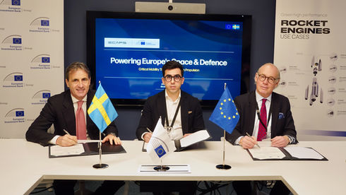
EIB Backs Sweden’s ECAPS with €20 Million to Advance Next-Gen Space and Defense Propulsion
The European Investment Bank is lending €20 million to Sweden’s ECAPS to scale next-generation, non-toxic propulsion systems for space and defense. The investment, EIB’s first for a Swedish space company, advances Europe’s dual-use capabilities, strengthens supply chain resilience, and accelerates critical mobility technologies across space and emerging domains.


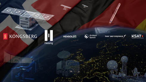
KONGSBERG and Helsing Forge Strategic Alliance to Accelerate Europe’s Sovereign Space Capabilities
KONGSBERG and Helsing have formed a strategic alliance to build Europe’s sovereign space-based intelligence and targeting constellation by 2029. With sensor technology from HENSOLDT and launch support from Isar Aerospace, the partnership aims to deliver a resilient, AI-driven IST architecture that strengthens Europe’s deterrence and defense capabilities.


OHB Sweden Wins Major Contract to Power SWISSto12’s Next-Gen HummingSat GEO Constellation
OHB Sweden has secured a major contract to deliver six electric propulsion systems for SWISSto12’s HummingSat, the first commercial SmallSat for GEO. The partnership strengthens European space sovereignty and promises to reshape the GEO market with agile, cost-effective satellite solutions.


Gogo Invests in Farcast to Accelerate Next-Generation Antenna Technology for Business, Military, and Government Aviation
Gogo has made a strategic investment in Farcast to accelerate next-generation aviation antennas that reduce SWaP-C while boosting bandwidth. Farcast’s full-duplex flat panel antenna and AESA technology will support Gogo’s multi-band, multi-orbit connectivity strategy for business, military, and government aviation.


Europe Commits Nearly €1 Billion to Next-Generation Satellite Navigation at ESA’s Ministerial Council
Europe has committed nearly €1 billion to advance next-generation satellite navigation at ESA’s Ministerial Council. The funding boosts NAVISP and FutureNAV while launching new missions like Celeste, Genesis, OpSTAR, NovaMoon, and Future PNT Demonstrators, strengthening Europe’s PNT resilience, competitiveness, and strategic autonomy.


Proximus Global and Starlink Partner to Bring Direct-to-Cell Satellite Connectivity Across Europe
Proximus Global and Starlink have formed a strategic partnership to expand direct-to-cell satellite connectivity across Europe. Leveraging Proximus Global’s IPX network, Starlink will link European mobile operators and support next-generation satellite-to-smartphone broadband. Kyivstar is the first operator to benefit, highlighting the critical role of satellite resilience in crisis environments.
Popular Tags
Stay Informed. Stay Ahead.
Your Daily Dose of Reliable News and Insightful Analysis.
Promoted Articles
bottom of page


